Mount Spurr eruption risk poses a significant threat to nearby communities. Learn how to stay prepared and informed.
Por: Marcelle em 13 de setembro de 2024
Última atualização em: junho 17, 2025
Anúncios
The Mount Spurr eruption risk includes significant hazards such as ash fall, lava flows, and pyroclastic flows, impacting nearby communities and emphasizing the importance of emergency preparedness and reliable information sources.
The Mount Spurr eruption risk is a significant concern for residents in the surrounding areas. With its history of volcanic activity, understanding the dynamics of this volcano can help ensure safety. Ever wondered how these eruptions affect your daily life?
Mount Spurr Eruption Risk and Preparedness
Category
Key Point
Impact
Geological History
Stratovolcano in the Aleutian Arc
Subduction causes eruption potential
Historical Eruptions
1953 and 1992 major ash events
Ash reached populated areas
Monitoring Tools
Seismic sensors, gas readings, aerial surveys
Detect early signs of eruptions
Ash Fall
Covers large areas with fine ash
Damages health, crops, machinery
Lava Flows
Slow but destructive movement
Destroys homes and roads
Pyroclastic Flows
Fast, hot volcanic material
Severe threat to life and structures
Emergency Plan
Evacuation routes and safety zones
Enhances family safety
Emergency Kit
Food, water, medicine, documents
Preparedness during disasters
Information Sources
USGS, AVO, NWS websites
Stay updated and alert
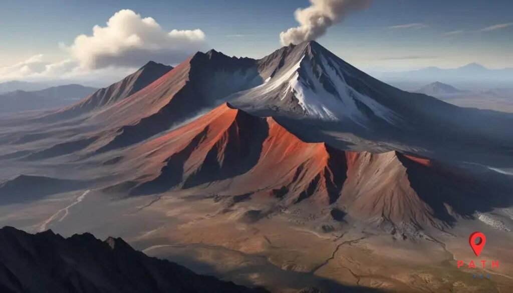
Understanding Mount Spurr’s geological history
Understanding Mount Spurr’s geological history is essential for grasping its potential eruption risks. This stratovolcano, located in Alaska, has a fascinating formation influenced by tectonic activities.
Mount Spurr is part of the Aleutian volcanic arc, where the Pacific Plate subducts beneath the North American Plate. This process creates intense heat and pressure, which contributes to volcanic activity.
Historical Eruptions
Mount Spurr has exhibited various eruptions throughout its history. Notable eruptions occurred in the late 20th century, including:
Anúncios
The 1953 eruption, which produced significant ash clouds.
The 1992 eruption, where ash reached populated areas.
These events highlight the need for continuous monitoring to assess future risks.
For official geological surveys and further in-depth information, visit the U.S. Geological Survey.
Current activity and monitoring efforts
The current activity at Mount Spurr is closely monitored by several geological organizations. These efforts are crucial to assess potential eruption risks and protect nearby communities.
Volcanologists utilize various tools to track changes in the volcano’s activity. This includes:
Seismic monitoring: Detecting tremors that indicate magma movement.
Gas measurements: Analyzing volcanic gases released by the volcano.
Aerial surveys: Observing surface changes and thermal activity from above.
By maintaining constant surveillance, experts can provide timely alerts if volcanic activity increases.
The potential impacts of an eruption from Mount Spurr are significant and can affect both the environment and nearby communities. Understanding these impacts is essential for preparedness.
An eruption can result in:
Ash fall: Ash can blanket areas far from the volcano, damaging crops, clogging machinery, and impacting air quality.
Lava flows: Although slower moving, lava can destroy anything in its path, including homes and infrastructure.
Pyroclastic flows: These fast-moving currents of hot gas and volcanic matter can obliterate anything in their way, posing a severe risk to life and property.
The scope of these impacts can be wide-reaching, affecting air travel, health, and local economies.
Emergency preparedness is essential for residents living near Mount Spurr. Being ready for a volcanic event can save lives and reduce property damage.
Here are key steps local residents can take:
Create an emergency plan: Identify evacuation routes and safe zones. Make sure all family members know the plan.
Build an emergency kit: Include essentials like water, food, medical supplies, and important documents.
Stay informed: Follow local news and alerts from authorities. Sign up for emergency notifications if available.
Being prepared allows communities to respond quickly and effectively in case of an eruption.
For additional resources on volcanic emergency preparedness, visit the Ready.gov.
Resources for staying informed about risks
Staying informed about volcanic risks is vital for residents near Mount Spurr. Access to reliable resources can help in understanding potential threats and safety measures.
Here are some key resources for monitoring volcanic activity:
U.S. Geological Survey (USGS): Offers real-time updates and detailed information on volcanic activity across the United States.
Alaska Volcano Observatory (AVO): Provides specific information on Alaskan volcanoes, including Mount Spurr, with alerts and reports available online.
National Weather Service (NWS): Issues alerts about ash fall and weather conditions that can affect safety during volcanic events.
Regularly checking these resources will enhance preparedness and safety.
Being aware of the eruption risks associated with Mount Spurr is essential for everyone living in nearby areas. With proper knowledge, preparation, and resources, communities can respond effectively to potential volcanic activity.
Residents should stay informed through official sources and have a well-thought-out emergency plan in place. The combined efforts of authorities and community readiness can greatly reduce the impacts of a volcanic eruption.
By prioritizing safety and preparedness, we can navigate the challenges posed by natural events like eruptions.
FAQ – Frequently Asked Questions about Mount Spurr Eruption Risks
What are the main risks associated with a Mount Spurr eruption?
The main risks include ash fall, lava flows, and pyroclastic flows, all of which can significantly impact nearby communities and the environment.
How can residents prepare for a potential eruption?
Residents can prepare by creating an emergency plan, building an emergency kit, and staying informed about volcanic activity.
Where can I find reliable information about volcanic activity?
Reliable information can be found on official sites like the U.S. Geological Survey and the Alaska Volcano Observatory, which provide updates and alerts.
What should I include in an emergency kit for volcanic eruptions?
An emergency kit should include essentials such as water, non-perishable food, medical supplies, flashlights, and important documents.